
Who discovered Antarctica and what facts are known about the continent?
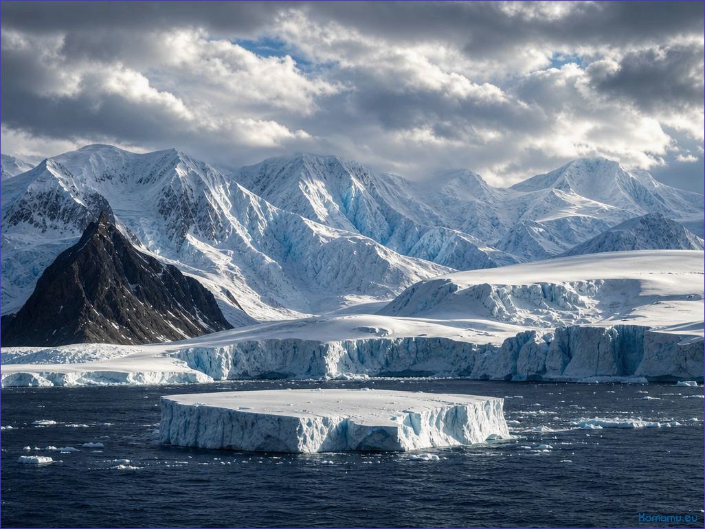
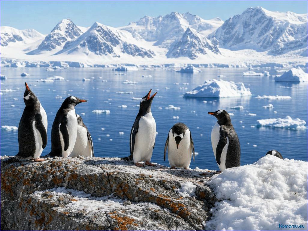
Antarctica is the southernmost continent on Earth, surrounded by the Southern Ocean. Its area is approximately 14 million square kilometers, making it the fifth-largest continent. Antarctica is covered by an ice sheet that contains approximately 70% of the planet’s fresh water. Temperatures here can drop to -80 degrees Celsius, making it one of the coldest places on Earth. Despite extreme conditions, Antarctic ecosystems are habitable. Penguins, seals, and various seabirds are typical representatives of the flora and fauna of this unique region. Scientific stations located here study climate change and natural resources, making Antarctica an important center of scientific activity.
The first recorded sighting of the continent dates back to 1820—a Russian expedition under the command of Thaddeus Bellingshausen and Mikhail Lazarev described coastal ice and land areas in late January 1820. Independent observations were made by the British explorer Edward Bransfield (January 30, 1820) and the American whaler Nathaniel Palmer (November 1820). These three events form the basis for claims of primacy, and the debate among historians is rooted in differences in the definition of “identification of the continent” and documentary sources.
Article Contents:
Previous expeditions matter: James Cook crossed The Antarctic Circle in 1773 proved that the hypothetical large continent to the south, as we know it, did not exist, but he discovered no coastline. The first documented landing is often attributed to the American John Davis (February 1821), although the evidence is controversial and the location has not been definitively confirmed archaeologically.
Physical characteristics: The continent covers an area of approximately 14 million km²; the Antarctic ice sheet contains approximately 26.5 million km³ of ice, the melting of which would raise sea levels by approximately 58 m. The average ice thickness is approximately 2 km. The lowest officially recorded temperature is -89.2 °C at Vostok Station (1983). The highest peak is Mount Vinson, 4,892 m. The population fluctuates seasonally: around 1,000 people in winter, up to several thousand in summer, housed at temporary and permanent stations; there are approximately 70 permanent research stations.
Ecology and Climate: Antarctica’s ecosystem is predominantly marine: a key species is the Antarctic krill (Euphausia superba), the basis of the food web for whales, penguins, and seals. Emperor, Adélie, and helmeted penguins inhabit the coasts; seals include Weddell’s spp., leopard seals, crabeater seals, and Antarctic fur seals. Terrestrial flora is limited to mosses, lichens, and a few angiosperms. The climate on the Antarctic Peninsula has shown significant warming in recent decades, while the central ice sheet remains extremely cold and stable in the short term; The threat lies in the potential instability of the West Antarctic Ice Sheet as the oceans continue to warm.
Practical recommendations and sources of information: If planning a trip, choose an operator with an IAATO membership. The best season to visit is the Australian summer (approximately November–March), with transport most often departing from Ushuaia, Punta Arenas, or Christchurch. Be aware of landing restrictions and animal handling regulations. For historical research and documentation, consult the Russian Voyage Archives (Bellingshausen), the Scott Polar Research Institute (Cambridge), and the Antarctic Treaty Secretariat and SCAR for current research and data. Follow IPCC publications and review articles on glacier mass dynamics to assess the impact of climate change on sea level and international conservation policy.
Which expeditions and observations are considered the first evidence of the existence of Antarctica?
James Cook (1772–1775 expedition, HMS Resolution and HMS Adventure) crossed the Antarctic Circle in 1773 and 1774, making detailed observations of a wide zone of drift ice and regular ice shelves at high latitudes. These observations demonstrated the presence of a large ice mass in the southern latitudes, although Cook did not confirm continental landmasses.
The discovery of the South Shetland Islands by Captain William Smith (Williams Coast, February 19, 1819) provided the first reliable evidence of land objects near Antarctic waters and prompted extensive fishing expeditions and mapping of the region in 1819–1820.

Independent observations of 1820 are considered critical for the recognition of the continent: the expedition of F.F. Bellingshausen and M.P. Lazareva (ships Vostok and Mirny, January 27–28, 1820) recorded a visible break in the pack ice and coastal ice shelves. A few days later, British sailor Edward Bransfield (brig Williams, January 30, 1820) reported sighting the extreme northwestern tip of the future Antarctic Peninsula. American navigator Nathaniel Palmer (sloop Hero, November 1820) recorded their approach to the coast and made independent reports.
The activities of whalers and trawlers in 1819–1821, including the supposed landing of John Davis (Hughes Bay, 1821), added empirical data on the possibilities of coastal landings and led to the creation of the first maps that recognized the presence of a continental mass to the south.
The observations, journals, and navigational charts of these expeditions formed the basis for a scientific consensus: several independent witnesses in 1819–1821 provided comparable descriptions of ice, coastal formations, and coordinates that have stood the test of subsequent research.
| Expedition / Sailor | Year | Ships | What was recorded |
|---|---|---|---|
| James Cook | 1772–1775 | HMS Resolution, HMS Adventure | Crossing the Antarctic Circle; Vast fields of drift ice and shelf formations |
| William Smith | February 19, 1819 | Williams Coast | Discovery of the South Shetland Islands (first reliable land-based evidence) |
| F.F. Bellingshausen and M.P. Lazarev | January 27–28, 1820 | Vostok, Mirny | Recording of coastal ice shelves and notes on the continental coastline |
| E. Bransfield | January 30, 1820 | Brig Williams | Sighting of the Northern End of the Antarctic Peninsula (Trinity Peninsula) |
| N. Palmer | November 1820 | Sloop Hero | Independent Approach and Reports of the Peninsula’s Shores |
| J. Davis (Disputed Landing) | 1821 | Fisherman’s Vessel | Claimed Landing in the Hughes Bay Area; Evidence of Possible Coastal Landings |
Study recommendation: Study the original journals of Bellingshausen, Bransfield, and the whalers’ diaries of 1819–1821 to compare observations and assess the reliability of the early accounts.
Present primary evidence: a dated ship’s log with coordinates and a description of the observation, confirmed by port records and an official publication or report to the appropriate naval authority.
Collect the following types of primary sources: ship logbooks with time, latitude, and longitude stamps; captain’s journals with descriptions of the coastline and weather conditions; navigational chronometer records and photographs of the sun or star altitudes; official reports to the Admiralty or Navy Department; port entry orders and customs/port stamps in extracts.
Look for printed and journal evidence: articles and notes in scholarly publications of the time, departmental bulletins and maritime lists (Lloyd’s List and similar), and port city newspapers—they record the arrival of ships, providing dates and names. Publication of a report in an academic or naval journal reinforces the priority.
Evaluate cartographic evidence: handwritten and printed maps with clear dates and names of compilers, notes on survey sources, engraving numbers, and information on reprints. Check the notes on the maps for surveying methods (angle measures, base triangles, azimuths) and references to expedition logs.
Use forensic techniques when in doubt: analyze watermarks and the chemical composition of ink to date the paper; examine the captain’s signature; trace the document’s origin through archive inventories and collection transfer records.
Correlate data from different sources: compare the coordinates and angles in the log with the map image, check the coastal configuration descriptions against modern satellite images, and verify timestamps in port documents and local newspapers.
Use archives and collections where evidence is most often stored: national naval archives (Admiralty and naval archives), national libraries and cartographic departments, maritime museums, specialized polar archives and institutes (centers that maintain catalogs of manuscripts and maps). Browse online catalogs and collections of digitized journals, but confirm authenticity through the original storage inventories.
Apply priority criteria when evaluating claims: precise dating of observation; availability of geographically meaningful coordinates; detailed description of visible coastline or ice mass; confirmation of the observation by independent records (other people’s logs, port documents, newspaper reports); and publication or official report within a reasonable time after the fact.
Create a research checklist: 1) the original logbook with coordinates and signature; 2) port stamps/extracts; 3) an official report or publication; 4) a map with the date and source of the survey; 5) independent confirmations; 6) a physical examination of the document. If any of these items are missing, downplay the claim and seek additional circumstantial evidence.
Contact specialists in navigational history and archival science for final attribution: they will help decipher navigational measurements, establish the accuracy of chronometers, conduct an examination of the materials, and determine which documents have priority in recognizing the discovery.
What controversial cases and parallel discoveries were recorded at the beginning of the 19th century?
I recommend considering the key episodes of 1819–1821 one by one, comparing dates, the nature of observations, and subsequent map refinements.
- William Smith — February 1819 (discovery of the South Shetland Islands).
- Essence: discovery of islands off the Antarctic Peninsula during a commercial voyage; This is the first reliably confirmed human presence in the area, but it concerns islands, not the mainland.
- Dispute: Some early publications confused the discovery of islands with the “discovery of the mainland,” which led to misunderstandings when comparing the 1820 claims.
- F.F. Bellingshausen and M. Lazarev – January 27, 1820 according to the Julian calendar (equivalent to February 8 according to the Gregorian calendar).
- Bottom line: The Russian expedition recorded a watch observation of an “ice coastline” and described extensive ice; the log contains coordinates and descriptions that are interpreted as the first sighting of the mainland.
- Dispute: The interpretation of the “ice coastline” – a natural ice barrier or solid land; The use of the Julian calendar caused confusion when comparing dates with British and American reports.
- Edward Bransfield – January 30, 1820 (British expedition).
- Essence: recorded coastal outlines, compiled the first rough sketches and navigational records for the Trinity Peninsula area.
- Dispute: the proximity in time to Bellingshausen’s observation and the difference in the nature of the description (the British records more clearly indicated land) gave rise to questions regarding priority.
- Nathanil Palmer – November 1820.
- Essence: American fishing captain sighted the coast in the Antarctic Peninsula area; American sources emphasize his role in the discovery of the continent.
- Dispute: Palmer – later in time compared to the events of January 1820; the dispute concerns not the date, but the right to co-authorship of the discovery of the continent among the three national schools (Russian, British, American).
- John Davis – February 7, 1821 (entry of a possible landing in the Hughes Bay area).
- Gist: In his logbook, Davis records an attempted landing; this is considered a candidate for the first documented landing of people on Antarctic land.
- Dispute: the wording of the logbook is ambiguous, the coordinates are disputed, some researchers doubt whether this was land or coastal ice.
- Benjamin Morrell and other late claims (1822–1823).
- Bottom Line: Morrell’s publications contain a number of far-fetched and often incorrect claims about new shores and latitudes.
- Controversy: Many claims are considered exaggerated or fictitious; such claims are not taken seriously in priority determinations.
Major Sources of Confusion:
- Different calendar systems (Julian for the Russians, Gregorian for the British and Americans);
- Ambiguity in the term “detection”—visible coastline, island, high ice floe, or solid land;
- Delays in publishing reports and subsequent changes in cartographic interpretations.
Practical recommendations for researchers of disputed claims:
- Check dates against the calendar indication and convert to the Gregorian calendar for comparison;
- Compare descriptions of the coastline (solid ice/rocky strip) with modern maps and satellite images;
- Check the sequence of publications and the presence of independent confirmation (other people’s logs, hydrographic notes, subsequent surveys);
- Exclude obviously discredited sources (such as Morrell’s inflated navigational fictions) when reaching your conclusion.
Brief summary: Bellingshausen’s Russian expedition and Bransfield’s British expedition compete for the first documented observations of the continent in early 1820; Palmer’s role as a parallel observer is more useful, and the question of the first reliable landing remains controversial due to ambiguities in John Davis’s journal.